California Wildfire images taken from outer space

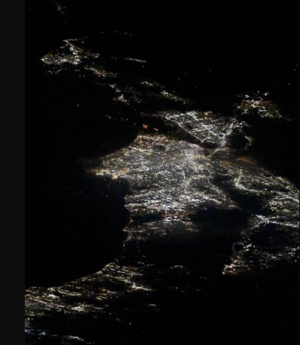
On January 10, 2025, NASA astronaut Don Pettit posted two images of the Los Angeles fires from the International Space Station. Multiple destructive fires broke out in the hills of Los Angeles County in early January 2025, fueled by a dry landscape and winds that gusted up to 100 miles per hour.

Multiple destructive fires broke out in the hills of Los Angeles County in early January 2025. As of January 8, several major wildland fires burned, fueled by a dry landscape and winds that gusted up to 100 miles per hour. The blazes have destroyed thousands of structures and prompted officials to issue evacuation orders in several parts of the county.
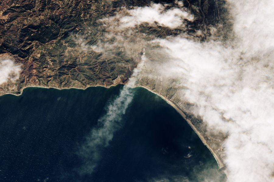
One of the wind-driven fires ignited during the morning of January 7, near the Pacific Palisades neighborhood. The image below, acquired by the European Space Agency’s Sentinel-2 satellite, shows the Palisades fire at 10:45 a.m. Pacific Time on January 7, soon after it ignited.
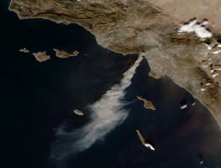
Smoke continued to stream from the Palisades fire toward the Pacific Ocean that afternoon, when the MODIS (Moderate Resolution Imaging Spectroradiometer) instrument on NASA’s Aqua satellite captured the image above. By the afternoon of January 8, it had moved westward along the Pacific Coast Highway toward Malibu, scorching over 11,000 acres (44 square kilometers), according to Cal Fire.

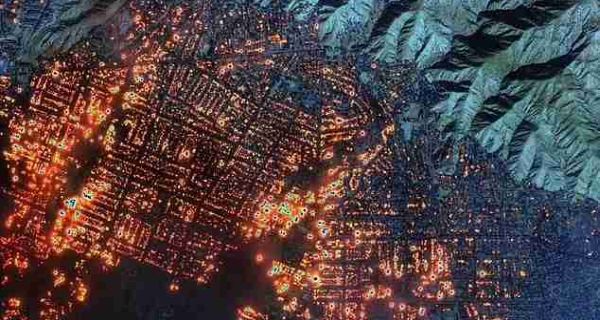
Farther inland, the Eaton fire erupted on the evening of January 7 in Altadena, north of downtown Los Angeles. The fire quickly spread to more than 10,000 acres, burning parts of Pasadena and Altadena. Another major fire, Hurst, broke out in San Fernando the night of January 7.
Powerful Santa Ana winds and a lack of rain created “critical” fire weather conditions in Southern California, according to the National Weather Service. Santa Ana winds typically occur between October and January when a pressure gradient builds up between the Great Basin to the east and the cool Pacific Ocean to the west. The weather pattern sends gusty, dry winds streaming down the side of inland mountain ranges, through narrow mountain canyons, and toward the coast.
Although windy conditions are typical this time of year, a lack of rain contributed to the dangerous fire weather. Since October, Southern California has received negligible rain, and according to climate scientist Daniel Swain, the region has experienced the driest start to the winter on record. The Los Angeles airport, for example, recorded 0.03 inches (0.08 centimeters) of rain since October 1—the start of the water year in the state—making it the area’s driest start to the water year on a record maintained by the National Weather Service dating back to 1944.
As of this writing, firefighters are still battling the deadly blazes in California, “with gusting winds overnight and early next week expected to threaten the progress they’ve made fighting the flames across the region,” according to CNN.
- The coastal Palisades Fire is at least 11% contained but now moving inland toward Brentwood and other communities near the Getty Center and UCLA.
- More than 100,000 residents remain under evacuation orders, as the Eaton Fire in Altadena and other blazes in the county continue to burn.
There have been at least 16 deaths and more than 10,000 structures have been damaged or destroyed. Firefighters made more progress on containing the Eaton and Palisades fires overnight, but the Palisades fire grew by about 1,000 acres and strong winds are expected overnight. ~ LA Times
–
(Sources: NASA Earth Observatory images by Wanmei Liang, using MODIS data from NASA EOSDIS LANCE and GIBS/Worldview and modified Copernicus Sentinel data (2025) processed by the European Space Agency. Story by Emily Cassidy.)
(Cover photo, Maxar Technologies / X)
Posted by Richard Webster, Ace News Today
Follow Richard on Facebook, Twitter & Instagram


